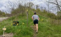
Finally! A Trail App for Rachel
For many of us, tackling the Rachel Carson Trail is daunting. Without the support offered through training hikes or the kind of assistance provided during events like the annual Rachel Carson Trail Challenge, many would understandably opt for taking a pass on a long hike conducted in isolation. Just figuring out where to park along the 45-mile expanse can be overwhelming.
To help with that, the RCTC created an online tool that simplifies the planning efforts for those tackling an excursion on our trails. The Plan a Hike tool empowers individuals to take on the trails with a level of confidence typically reserved for veteran hikers who have already logged countless miles.
The tool, which is found on the Rachel Carson Trail page of our website, is fully integrated with the adjacent map on the page. There are two different ways to use the tool. The first and more popular option is to plan your excursion using the drop-down menu which alphabetically lists parking locations. This option includes every possible parking spot and every conceivable ending location. You will find more than one hundred segments from which to choose! The tool’s second option offers similar prospective hikes categorized by distance. In either scenario, your chosen start and end points come with map links to Google where you can get driving directions.
The Plan a Hike tool is also available on the Baker Trail page and allows hikers (and runners) to plan excursions on our 134-mile path.
While the tool can assist in planning your hikes, once your feet hit the trail, the rest is up to you! Follow the yellow blazes. Good luck and happy trails!
Amy Nelson is an avid trail runner and a member of the Rachel Carson Trails Conservancy Board of Directors.
